Lesson 6 of 11 · about 50 minutes · Updated November 18, 2026
Subdivisions and Plats, Step by Step: How a Farm Becomes a Neighborhood
You'll be able to
- Apply Idaho Code 50-1301's five-lot definition, its farm exception and local short plat rules to a proposed land division.
- List the steps from concept review to recorded plat and identify which body decides each one under Idaho Code 67-6504 and 50-1308.
- Name the certificates and signatures a plat needs before the county recorder accepts it, including the sanitary restriction and the water system certification.
- Explain how Senate Bill 1083 (2025) and Senate Bill 1222 (2026) changed irrigation and well requirements for new subdivisions.
- Identify where the public can comment, who counts as an affected person, and the 14-day, 60-day and 28-day deadlines for reconsideration and judicial review.
- Use county recorder and assessor records and city case files to rebuild a subdivision's timeline and count plats over time.
Start here: the short version
- Five lots is the state default. Idaho Code 50-1301(18) calls a tract divided into five or more lots "for the purpose of sale or building development" a subdivision, exempts farm splits where every lot is five acres or larger and stays in farming, and lets each city and county write its own definition instead.1
- Only elected boards give final approval. A planning and zoning commission can hold hearings and recommend, but Idaho Code 67-6504 bars it from the authority "to finally approve land subdivisions." That power stays with the city council or the board of county commissioners.2
- A plat cannot be recorded without a stack of signatures: the owner, the land surveyor, a county-chosen surveyor who checks the math, the city engineer and clerk or the county board, the highway district where one exists, and the county treasurer within 30 days before recording (Idaho Code 50-1305, 50-1308, 50-1309 and 50-1312).34
- Water rules changed in 2025 and 2026. Senate Bill 1083 (2025) rewrote Idaho Code 31-3805 so a subdivision with surface water "reasonably available" must irrigate its lots with it, and a shared well inside a city's service area or area of city impact must be built to connect to the city. Senate Bill 1222 (signed Feb. 17, 2026) limited those changes to applications filed after June 30, 2025.567
- Two 2026 laws reach into subdivisions. Senate Bill 1352 makes cities over 10,000 people allow "starter home subdivisions" with lots of no more than 1,500 square feet by Feb. 1, 2027 (Idaho Code 67-6542), and House Bill 707 lets cities and counties split off an accessory dwelling unit for financing without a full plat (Idaho Code 50-1335, effective July 1, 2026).89
- Ada County recorded 145 subdivision plats in 2025, against a peak of 240 in 2005 and a low of 49 in 2010 (the fewest since 1982), by our count of the Ada County Assessor's subdivision map layer. No Magic Valley county publishes a comparable series.10
- Neighbors and builders both win in court when the record is thin. The Idaho Supreme Court set aside Boise's approval of the Prominence preliminary plat in 2023 for lack of a reasoned statement, and in 2024 upheld Twin Falls County's denial of more lots at Shoshone Heights on the canyon rim because the plan had only one way out.1112
Law: Idaho Code as amended through the 2026 regular session (Senate Bill 1222, House Bill 707, Senate Bills 1352 and 1354, House Bill 926); Idaho Supreme Court opinions through Nov. 18, 2026; Twin Falls City Code Title 10 as adopted Dec. 8, 2025 and in effect Jan. 1, 2026; Ada County Assessor subdivision records through Oct. 30, 2026; U.S. Census Bureau Vintage 2025 city population estimates. Checked Nov. 18, 2026. Laws, local codes and data change; check the current statute, the current city or county code and the newest release.
Every subdivision in Idaho starts as a legal description on a deed and ends as a numbered lot on a recorded map. In between sit two state laws, one local ordinance, a dozen public agencies and a sequence of drawings, hearings, bonds and signatures that can take a year or two for a single phase and longer for a large project. The farm field on the edge of Meridian, Kuna, Twin Falls or Jerome does not become a street of houses because someone bought it. It becomes one because a plat was approved and recorded.
This lesson walks through that sequence step by step, using the actual code sections of the City of Twin Falls (rewritten effective Jan. 1, 2026) and the City of Meridian, a real Meridian subdivision file from preliminary plat to fifth recorded phase, and the Idaho Supreme Court cases that show where approvals and denials go wrong. It explains where the public can comment and appeal, what the 2025 and 2026 water and housing laws changed, and what the county records can and cannot show about how many lots Idaho is creating.
It builds on, and does not repeat, the shorter lesson Subdivisions, Plats and Impact Fees in the Idaho Planning and Zoning module, which covers the basic definitions and a proportionate-share impact fee example. Annexation, which usually comes first, is in Annexation Fights. Who pays for the pipes and roads a subdivision needs is in Impact Fees, Urban Renewal and Who Pays for Growth. Standing, takings and the "affected person" rule are in Property Rights and Land Use Law. How much farmland has turned into rooftops is measured in Farmland to Rooftops in Part A of this series. Homeowners associations and their rules get a full treatment in Part C of this series, coming later; here they appear only where they are born, on the plat.
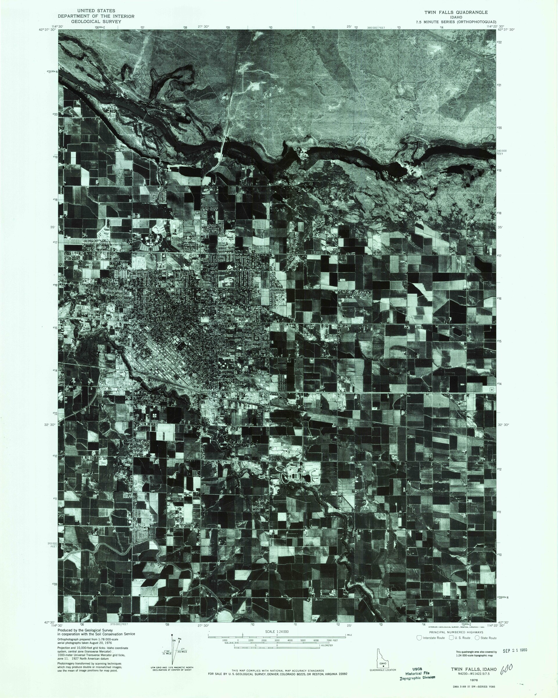
What counts as a subdivision
The word has a legal meaning that matters more than its everyday one. If a land division is a "subdivision," the owner must survey it, draw a plat, get it approved and record it before selling lots. If it is not, the owner may be able to sell parcels by deed with a record of survey and no public hearing at all.
The five-lot default and the farm exception
Idaho Code 50-1301(18) sets the default: a subdivision is "a tract of land divided into five (5) or more lots, parcels, or sites for the purpose of sale or building development, whether immediate or future." The phrase "whether immediate or future" is aimed at owners who split a tract today and plan to build later. The same subsection carves out "a bona fide division or partition of agricultural land for agricultural purposes," which it defines as lots "all of which are five (5) acres or larger and maintained as agricultural lands."1
The section has been amended 15 times since it was enacted in 1967 (Idaho Session Laws 1967, ch. 429), most recently in 2024 (ch. 62) and in 2022 (ch. 43). The five-lot rule itself is old; the list of definitions around it has grown to include surveying terms such as "basis of bearing," "reference point" and "witness corner."1
Cities and counties can write their own definition
The last sentence of 50-1301(18) is the one that matters most locally: "Cities or counties may adopt their own definition of subdivision in lieu of this definition." Idaho Code 67-6513, part of the 1975 Local Land Use Planning Act, then requires every city council and board of county commissioners to adopt a subdivision ordinance setting "standards" and a process "for the processing of applications for subdivision permits."113 The result is that the real rules for any parcel are in the city or county code, read alongside Title 50, Chapter 13.
Local codes use that freedom in different ways:
- Twin Falls sends every subdivision through four reviews (concept, short plat or preliminary plat, public infrastructure construction plan, final plat) and offers a "short plat" for small infill divisions: no more than five acres, no more than five lots, and a "parent" parcel that was not itself created by a short plat within the last 10 years. The city engineer decides short plats as a hearing examiner after mailing notice to owners within 100 feet, with a 10-day comment period.14
- Meridian allows a combined preliminary and final plat when a subdivision does not exceed four buildable lots (not counting planting lots) and needs no new street dedication, and a separate "short plat" path for small divisions of previously platted land.15
- Counties often handle splits of rural land through "administrative" land divisions or records of survey for one or a few parcels, then require a full plat above a threshold. The number varies by county, so the county code is the place to check.
What happens if an owner skips the plat
Title 50 has three enforcement tools, all old and rarely used, and all still on the books:
- The county can make the plat itself. When an owner has "divided and sold or conveyed five (5) or more parts" of a tract without a plat, the county recorder, at the commissioners' direction, can demand one. If the owner does not file within 30 days, the recorder has a plat surveyed and recorded and the county assesses the cost against the lots, collected like property taxes (Idaho Code 50-1314, amended 2011).16
- A fine per lot. Anyone who sells or offers lots before the plat is acknowledged and recorded "shall forfeit and pay one hundred dollars ($100) for each lot" (Idaho Code 50-1316). The amount has not changed since 1967.17
- A misdemeanor for building too early. Building a house or installing water and sewer before the sanitary restriction is satisfied is a misdemeanor, and each day is a separate offense (Idaho Code 50-1329).18
Local codes add their own bars. Twin Falls says flatly that "No lots shall be sold until the Final Plat has been recorded in the office of the County Recorder."14
Who decides, and under what law
Two statutes, one process
Idaho's subdivision law comes in two layers that were written eight years apart. The platting law, Title 50, Chapter 13, was enacted in its current form in 1967 as part of a recodification of city law (Idaho Session Laws 1967, ch. 429). It governs the physical plat: the survey, the monuments, the drawing, the certificates, the recording and the sanitary restriction.19 The Local Land Use Planning Act of 1975 (Idaho Code Title 67, Chapter 65; Idaho Session Laws 1975, ch. 188) governs the decision: who hears the application, what notice is given, what standards apply, and how a decision is appealed. Section 67-6513 ties them together by requiring each local subdivision ordinance to process applications "under sections 50-1301 through 50-1329, Idaho Code."13
The history of LLUPA itself, and how zoning reached Idaho, is in How Zoning Came to Idaho.
City, county, or area of city impact
Which government reviews a plat depends on where the land sits:
- Inside city limits: the city council approves the plat, and the recorder may not accept it unless it carries "the acceptance and approval of the said city council and bear[s] the signature of the city engineer and city clerk" (Idaho Code 50-1308(1)).3
- Outside city limits: the board of county commissioners approves it.3
- In an area of city impact: plats "shall be administered in accordance with the provisions set forth in the adopted city or county zoning and subdivision ordinances having jurisdiction" under the impact area agreement (Idaho Code 50-1306). Where no impact area has been adopted, the county must send plats within one mile of a city to that city for comment at least 14 days before its first decision, and "shall consider all comments submitted by the city."20
The area of city impact rule explains a Magic Valley case discussed below: when Twin Falls County denied more lots at Shoshone Heights, it applied a section of the Twin Falls City Code, because the land sat in the city's impact area.12 How impact areas are drawn and renegotiated is in Areas of City Impact and Annexation.
The commission recommends; the council or county board decides
Idaho Code 67-6504 lets a city council or county board create a planning and zoning commission "which may act with the full authority of the governing board, excluding the authority to adopt ordinances or to finally approve land subdivisions."2 So in every Idaho city and county, the final plat goes to the elected board. The preliminary plat can be decided by the commission if local code says so (Twin Falls), or recommended by the commission and decided by the council (Meridian).1415
Idaho Code 67-6520 adds a third option: a hearing examiner, defined as "professionally trained or licensed staff planners, attorneys, engineers, or architects," can hear subdivision applications if a local ordinance authorizes it, and can decide or recommend.21 Twin Falls uses that power for short plats, naming the city engineer as the hearing examiner.14
| Idaho Code section | What it requires | Enacted; latest amendment |
|---|---|---|
| 50-1301 | Definitions, including "subdivision" (five or more lots), "plat," "private road," "sanitary restriction" | 1967; 2024, ch. 62 |
| 50-1302 | Owner creating a subdivision must survey, plat and record | 1967; 2011, ch. 136 |
| 50-1303 | Monuments (5/8-inch iron rod, 2 feet long, magnetically detectable) and survey accuracy of 1 part in 5,000 | 1967; 2011, ch. 136 |
| 50-1304 | Plat sheet size (18 by 27 inches), what the drawing must show, interstate pipelines within 1,000 feet | 1967; 2023, ch. 140 |
| 50-1305 | County picks a professional land surveyor to check the plat; subdivider pays a fee | 1967; 1997, ch. 190 |
| 50-1306 | Areas of city impact; county sends plats within 1 mile of a city for 14-day comment | 1967; 1999, ch. 391 |
| 50-1308 | City or county approval; treasurer certifies within 30 days before recording | 1967; 1997, ch. 190 |
| 50-1309 | Owner's certificate and dedication; surveyor's certificate; private roads | 1967; 1997, ch. 190 |
| 50-1312 | Recording works as a deed for dedicated land; highway district must endorse | 1967; 1992, ch. 262 |
| 50-1326 to 50-1329 | Sanitary restriction until DEQ approves water and sewer; misdemeanor to build early | 1971; 2001, ch. 103 |
| 50-1331 to 50-1333 | Interior monuments may be set after recording, with a 120 percent bond | 1987; 2012, ch. 25 |
| 50-1334 | Owner certifies the drinking water source and compliance with 31-3805(2) | 1990; 2026, ch. 2 |
| 50-1335 | Optional administrative split for an accessory dwelling unit, for financing | 2026, ch. 170 |
| 31-3805 | Irrigation water delivery within subdivisions; city-compatible shared wells | 2025, ch. 129; 2026, ch. 2 |
| 67-6513 | Every city and county must adopt a subdivision ordinance | 1975; 2003, ch. 142 |
| 67-6542 | Starter home subdivisions in cities over 10,000 (printed as 67-6541 in the session law) | 2026, ch. 264 |
Source: the history line at the end of each section on the Idaho Legislature's website, read Nov. 18, 2026.22232425262728
From farm field to first house, step by step
The order below is the common Idaho sequence. State law fixes the end of it (approval by the elected board, the certificates, recording and the sanitary restriction). Local ordinances fix the beginning and the middle, so the names of steps and the number of days differ from city to city. Where the two worked examples in this lesson differ, both are given.
- Get the zoning and the city limits right first. A plat must meet the zone that already applies to the land. A farm parcel zoned for agriculture in the county usually has to be annexed into a city and zoned for houses, or rezoned in the county, before a residential plat can be approved. Annexation and rezoning are legislative decisions with their own hearings; see Annexation Fights and Zoning Ordinances, Maps and Rezones. Cities often hear a rezone, a development agreement and the preliminary plat together; the Meridian final plat order for Prescott Ridge refers back to a single earlier case, H-2020-0047, and to a recorded development agreement for its conditions.29
- Meet with staff before filing. Twin Falls requires a "Subdivision Concept" review: the developer submits a sketch of streets, blocks and lots, and within 15 business days the administrator reports whether it conforms to the code, whether a rezone or variance is needed, what environmental or hazard features matter, and which other agencies to contact. There is no fee, and the concept approval is good for one year.1430 Meridian requires a pre-application conference and a neighborhood meeting before a preliminary plat is filed.15
- File the preliminary plat application. The preliminary plat is a design drawing, not yet a survey for recording. Twin Falls asks for a 24 by 36 inch drawing at no less than 1 inch to 100 feet, every phase shown, existing utilities and ditches, a list of owners within 300 feet, a copy of the draft CC&Rs, a review letter from the Twin Falls Canal Company, and water and sewer modeling, paid for by the developer, showing the city can serve the lots without hurting service to existing customers.3114 Meridian's checklist asks for a narrative, the deed, a subdivision name cleared by the Ada County Surveyor, a planting plan, an open space exhibit for plats over 5 acres, conceptual building elevations and a soils report on the highest seasonal groundwater.32
- Agencies review and staff writes a report. The city engineer reviews every Twin Falls preliminary plat before the commission acts, and the administrator may send it to other governments with joint jurisdiction, utilities, "irrigation companies or districts and drainage districts," the school superintendent and others, each with at least 10 days to comment.14 State law separately requires notice to every irrigation district, ground water district, Carey Act company, lateral ditch association and drainage district that has asked in writing to be notified, at least 15 days before the hearing, and since 2023 to any interstate gas or petroleum pipeline company whose line runs within 1,000 feet (Idaho Code 67-6519(4), amended 2023, ch. 140).33 The staff report is the single most useful public document in the file: it lists the code sections, the agency comments and the proposed conditions.
- Notice goes to neighbors. Twin Falls mails written notice, with the plat drawing, to owners within 300 feet at least 15 days before the meeting, and the applicant posts a blue sign at least 2 feet by 3 feet reading "Notice of Subdivision" on each street frontage, also 15 days ahead.14 Other cities use different distances and days; the local code controls.
- The commission decides or recommends. In Twin Falls, the Planning and Zoning Commission decides the preliminary plat, and "A public hearing is not required to consider a preliminary plat." The commission must consider the code's standards, "General conformance" with the city's long-range plan, the availability of public services, and health, safety or environmental problems brought to its attention. It may approve, approve with conditions, deny, or table once to its next regular meeting.14 In Meridian the commission holds a hearing and recommends, and the City Council decides.15 Where no hearing is scheduled, state law lets any affected person petition in writing for one before final action, and "if twenty (20) affected persons petition for a hearing, the hearing shall be held" (Idaho Code 67-6521(1)(b)).34
- The decision must be written and reasoned. Every approval or denial must name the ordinance and standards used, the reasons, and what the applicant could do to get approval (Idaho Code 67-6519(5)), and it must come with "a reasoned statement that explains the criteria and standards considered relevant, states the relevant contested facts relied upon, and explains the rationale" (Idaho Code 67-6535(2)).3335 Twin Falls gives itself 30 days to deliver the written decision.14
- Engineers draw the construction plans. After preliminary approval, a licensed engineer prepares plans, profiles and specifications for streets, water, sewer, storm drainage, street lights, pathways and irrigation (Twin Falls City Code 10-12-4-1).14 New public water and sewer systems need plan approval from the Idaho Department of Environmental Quality, which by statute tries to resolve design issues within 42 days; extensions of city-owned mains can be approved by the city's own licensed engineer instead and reported to DEQ (Idaho Code 39-118(1) and (2)(d)).36
- Build the improvements or post a guarantee. A final plat is normally approved only after streets and utilities are built and accepted, or after the developer posts a surety. Twin Falls accepts cash, a certified check, a bond, an irrevocable letter of credit or a surety bond under an "Improvement Agreement for Developers."14 Meridian's conditions for Prescott Ridge No. 1 required a letter of credit or cash of 110 percent of the cost of unfinished fencing, planting, amenities and pressurized irrigation, a surety of 125 percent of the cost of unfinished sewer and water, and a two-year warranty surety of 20 percent of the cost of completed sewer and water.29
- Apply for the final plat. The final plat is the surveyed, recordable version. Staff checks it for "substantial conformance" with the preliminary plat; if it departs substantially, Twin Falls can send it back through the commission. Twin Falls places final plats on the City Council's consent agenda, and the council approves, approves with conditions, denies or tables.14 Meridian's City Council approved the final plat for Prescott Ridge No. 1 after staff found "the same number of buildable lots and common open space as shown on the approved preliminary plat."29
- Collect the signatures and certificates. Before recording, Twin Falls requires the approved plat, approved construction plans, the financial guarantee, a weed management plan, DEQ certification of the water and sewer plans, highway district approval where it applies, Twin Falls Canal Company approval of the gravity irrigation system, an executed improvement agreement, proof of a stormwater pollution prevention plan filed with DEQ, and transfer to the city of water share certificates "equal to one share per gross acre for new residential developments."14 The plat sheet itself carries the state-required certificates shown in the graphic below.
- Record the plat. The county recorder files it in the "Records of Plats" (Idaho Code 50-1310). Recording "is equivalent to a deed in fee simple" of the land shown for public streets or other public use (Idaho Code 50-1312). From that day, lots can be described and sold by lot and block number (Idaho Code 50-1302).37419
- Clear the sanitary restriction and pull permits. Until DEQ or the health district approves the water and sewer arrangements and that approval is recorded, no one may build a structure that needs water or sewer (Idaho Code 50-1326). After that, the builder applies for building permits lot by lot, and Meridian, for example, will not issue a building permit until the property "shall be subdivided in accordance with the UDC."2629
The preliminary plat is a promise; the final plat is the record
The difference between the two is the source of much confusion at public hearings. The preliminary plat is where the layout is decided: how many lots, where the streets connect, how big the open space is, which lots back onto an arterial. That is the hearing where neighbors' comments can change the design. The final plat is where the survey is checked against the approved design; by law and by local code it must match. A council that approved a preliminary plat has very little room to deny a final plat that conforms to it and meets its conditions. Comments about density or traffic made at the final plat stage usually come too late.
What the staff report and conditions contain
The Meridian file for Prescott Ridge No. 1 (case FP-2021-0053) shows what a final plat order looks like in practice. The order approved 108 building lots and 27 common lots on 27.42 acres in the R-8 zone, east of N. McDermott Road and south of State Highway 20-26, for owner Providence Properties, LLC. The attached staff report, dated for a Feb. 15, 2022 council hearing, carried 13 planning conditions, 11 site-specific public works conditions and 24 general conditions. Among them:29
- comply with the earlier conditions and the recorded development agreement (Ada County instrument 2021-132713);
- get the city engineer's signature on the final plat by June 1, 2023, two years after council approval of the preliminary plat, or ask for an extension;
- pay sewer reimbursement fees of $265.25 and $185.43 per equivalent residential unit for the Oaks lift station and its pump upgrades before city signatures;
- build a noise berm for the future State Highway 16 extension, and break up the rear and side walls of two-story houses on lots facing N. McDermott Road and N. Rustic Oak Way;
- set street centerlines at least 3 feet above the highest established groundwater so crawl spaces stay at least 1 foot above it;
- abandon unused wells under Idaho Department of Water Resources rules and septic systems with Central District Health;
- supply the pressurized irrigation system from a year-round source, using existing surface or well water first.
Conditions like these are where most of the real negotiation in a subdivision happens. They are public, and they are enforceable: Meridian's order ties the city engineer's signature to proof that off-site improvements are complete or bonded.29

The plat itself: survey, monuments and certificates
The survey and the monuments
A plat begins in the field. Idaho Code 50-1303 requires street centerline intersections and every change in direction of the exterior boundary to be marked with "magnetically detectable monuments" at least five-eighths of an inch thick and two feet long, iron or steel, and every lot and block corner to be marked under the surveyors' licensing law. Measurements between monuments must be possible "to the nearest one-tenth (0.1) foot," and the survey must close to within "one (1) part in five thousand (5,000)."22
Interior lot pins are often set after the streets are built, so they are not torn out by excavators. Since 1987 the law has allowed that: the plat may be recorded with only the exterior monuments set if the surveyor certifies a date, no later than one year after recording unless the city or county sets another, and the subdivider posts a bond or cash equal to 120 percent of the surveyor's estimated cost (Idaho Code 50-1331 to 50-1333).27
What the drawing must show
Idaho Code 50-1304 is specific about the drawing. Plats are 18 by 27 inches on stable drafting film, with a 3.5-inch binding margin on the left. They must show streets and alleys with widths and courses, a name for each street, lots numbered within lettered or numbered blocks, the length of every lot line, the exterior boundary by distance and bearing, the monuments, a point of beginning tied to at least two survey corners, the easements, a north arrow and scale, the subdivision name, and a surveyor's narrative. Since 2023 they must also show any interstate natural gas or petroleum pipeline whose center lies within 1,000 feet (Idaho Session Laws 2023, ch. 140).23
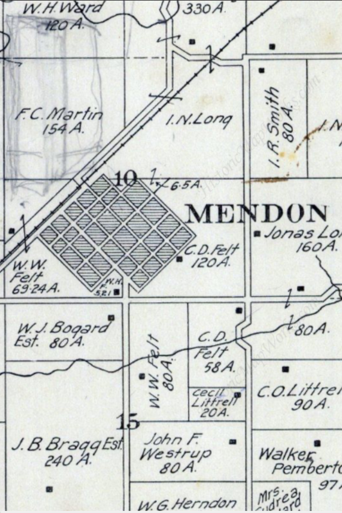
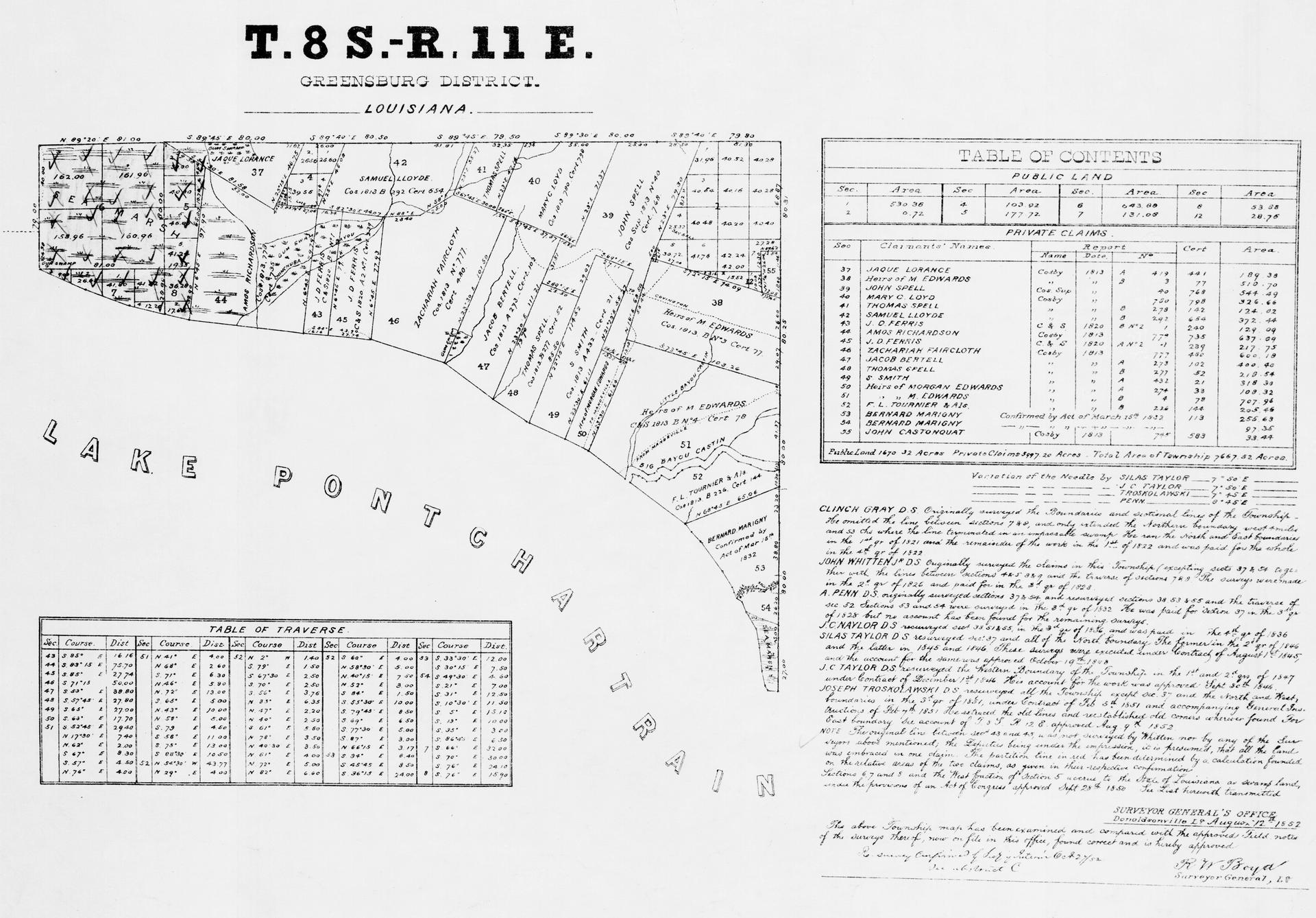
The legal description ties the subdivision to the federal rectangular survey. The Prescott Ridge No. 1 plat, for example, describes "a portion of the NE 1/4, the SW 1/4 and the NW 1/4 of Section 28, Township 4 North, Range 1 West, B.M." The letters B.M. stand for the Boise Meridian, the reference line of the federal land survey in Idaho: ranges are counted east and west of it, and townships north and south of a base line that crosses it.29
The certificates, one by one
| Certificate or signature | Who signs | What it does | Idaho Code |
|---|---|---|---|
| Owner's certificate and dedication | Every owner, before a notary | States the legal description, the intent to plat, and dedicates public streets and rights-of-way | 50-1309(1) |
| Surveyor's certificate | The professional land surveyor who made the survey | Certifies the plat is correct, with seal, signature and date | 50-1309(1) |
| Checking surveyor | A professional land surveyor chosen by the county | Checks the plat and computations; subdivider pays a fee set by ordinance | 50-1305 |
| City approval | City council, city engineer, city clerk | Required for any plat needing city approval | 50-1308(1) |
| County approval | Board of county commissioners | Required for plats outside city limits | 50-1308(1) |
| Highway district acceptance | Highway district commissioners | Required "in a county where a highway district exists and is in operation" | 50-1312 |
| Treasurer's certificate | County treasurer | Within 30 days before recording; may be withheld only for unpaid county property taxes | 50-1308(1) |
| Sanitary restriction | Printed on the plat; satisfied by a DEQ or health district certificate | Bars buildings needing water or sewer until approval | 50-1326 |
| Water system certification | Person recording the plat | States which of three drinking water options applies and compliance with 31-3805(2) | 50-1334 |
| Irrigation notes | On the plat | Names the irrigation entity, states that a delivery system was provided and approved, and that lot owners owe its assessments | 31-3805(5) |
Sources: Idaho Code sections listed, read Nov. 18, 2026.25243426285
Two of those rules surprise people. The treasurer's certificate is narrow: "The county treasurer shall not withhold certification for any reason except for county property taxes due, but not paid."3 And a dedication is not the same as acceptance. Under Idaho Code 50-1313, no dedicated street becomes a public street "unless the dedication shall be accepted and confirmed by the city council or by the commissioners of the highway district," and even acceptance "imposes no obligation or liability" until the street is declared open for public travel.38
Recording and the county recorder
The recorder files the approved plat with the date endorsed on it, binds it into the "Records of Plats," keeps the original "in a reproducible condition," keeps counter copies for the public, and sells full-scale copies at the fee allowed by Idaho Code 31-3205 (Idaho Code 50-1310, last amended 2015).37 A plat that lacks the sanitary restriction or the DEQ certificate may not be recorded, but if one slips through, "The filing and recording of a noncomplying plat shall in no way invalidate a title conveyed thereunder" (Idaho Code 50-1327).39
A recorded plat is changed by recording a new one or by a vacation. To vacate a plat inside a city, the owner petitions the council, mails notice to owners within 300 feet at least 10 days before the hearing, and publishes notice twice in the city's official newspaper (Idaho Code 50-1306A, amended 2024, ch. 100). Platted land outside public rights-of-way "need not be vacated in order to be replatted."40

Sanitary restrictions and the health district
The sanitary restriction dates to 1971 (Idaho Session Laws 1971, ch. 329). Every plat recorded under Title 50, or under a county ordinance, must carry it unless a DEQ certificate of approval for the water and sewer facilities is recorded with it. The certificate "may be issued for the subdivision or any portion thereof," so a developer can clear phases separately. And the restriction can come back: DEQ may reimpose it after notice and a chance to appeal if construction does not follow the approved plans.26 The state Board of Environmental Quality writes the standards, which may turn on "size of lots, contour of land, porosity of soil, ground water level," and similar factors (Idaho Code 50-1328).41
In practice the local public health districts do much of this work under DEQ's rules. Eastern Idaho Public Health's procedure for septic subdivisions is typical: a pre-application meeting, test holes dug with health district staff present, and, if groundwater is within 10 feet of the surface, monitoring "through a complete spring and summer season" before the district decides whether the Subsurface Sewage Disposal Rules (IDAPA 58.01.03) can be met and gives the developer the sanitary restriction language for the plat.42 In the Magic Valley, the South Central Public Health District's July 2026 application asks for total acres, number of buildable lots, minimum and average lot size, the water source, and the sewage method, and requires a "Will Not Serve" letter from the city if individual septic systems are proposed within 2,000 feet of municipal sewer. The district takes applications at offices in Twin Falls, Jerome, Gooding, Heyburn and Bellevue.43
Water, ditches and wells
In irrigated Idaho a subdivision is also a water project. The farm being platted usually carries surface water rights or shares in a canal company, laterals run across or beside it, and the houses will need drinking water from a well or a city. Three statutes govern those questions, and two of them changed in 2025 and 2026. Background on water rights, irrigation districts and canal companies is in the module Irrigation Districts, Canal Companies and Ditch Rights.
Surface water first
Since 1989, Idaho Code 67-6537 has required "All applicants proposing to make land use changes" to use surface water, "where reasonably available, as the primary water source for irrigation." Surface water counts as reasonably available if a water right is or can be made appurtenant to the land, if the land is entitled to water from an irrigation district or canal company whose system can deliver it, or if such an entity has spare rights it can allocate and a system that can reach the land. The 2025 water bill amended this section (Idaho Session Laws 2025, ch. 129).44
Idaho Code 31-3805, as rewritten in 2025, puts teeth in that rule for plats. If surface water is reasonably available, "no subdivision plat, amendment to a subdivision plat, or any other plat or map recognized by the city or county for the division of land will be accepted, approved, and recorded unless the owner or entity has provided for the irrigation of lots within the subdivision using the available surface water." The plat must describe the delivery system from the irrigation entity's point of delivery to each lot; a city council or county board approves the system "with the advice of the irrigation entity"; and the plat must carry notes naming the irrigation entity and stating that each lot buyer "shall remain subject to all assessments levied by the irrigation entity" and that unpaid assessments are a lien on the land.5
Twin Falls adds its own rule on top: before recording, a residential developer must transfer to the city water share certificates "equal to one share per gross acre," or another number set by a separate agreement with the council, and get the Twin Falls Canal Company's approval of any gravity irrigation system.14
Domestic wells and the 2025 and 2026 changes
Senate Bill 1083 (2025), sponsored by the Senate Resources and Environment Committee with Sen. Kelly Anthon and Rep. Pickett carrying it on the floors, passed the Senate 32 to 1 on March 5, 2025 and the House 63 to 2 on March 14, and was signed by Gov. Brad Little on March 19, 2025, effective July 1, 2025 (Idaho Session Laws 2025, ch. 129).6 Its statement of purpose lists four changes: it lets several exempt domestic uses share a single well (in-home use only); in subdivisions inside a Ground Water Management Area, Critical Ground Water Area or moratorium area, it limits the domestic well exemption to in-home and stock watering use, so lawn irrigation needs a water right permit; it creates a faster enforcement process (new Idaho Code 42-1701B); and it amends 31-3805 so community wells in a city's service area or impact area are compatible with the city system and surface water is used for irrigation when available.45
Senate Bill 1222 (2026) followed. It passed the Senate 29 to 0 on Jan. 30, 2026 and the House 69 to 0 on Feb. 11, and became Idaho Session Laws 2026, ch. 2, effective Feb. 17, 2026.7 Its statement of purpose says it defines "subdivision" for the two well sections as a development with five lots and clarifies that the 2025 limits apply only to subdivisions with final applications filed on or after July 1, 2025.7 The current text of 31-3805(1) says a completed application filed on or before June 30, 2025 "is governed by the law as it existed at the time of filing."5 The Idaho Association of Counties, which supported the bill, told its members that "Planning and Zoning departments will likely need to update their review processes for subdivision plats."46 How the domestic well exemption works is explained in Domestic Wells and Exempt Uses.
Who supplies drinking water
Idaho Code 50-1334, added in 1990, makes the person recording any plat subject to the sanitary restriction certify compliance with 31-3805(2) and one of three things: the lots will be served by individual wells and no common system; every lot is eligible for service from an existing municipal system, water district, regulated utility or nonprofit water company that "has agreed in writing to serve all of the lots"; or a new system will be built with enough "contributed capital" that lot owners face no further connection charges except for their own laterals and meters. Failing to comply is a misdemeanor, and the certification must be recorded with the plat.28 The third option exists to protect buyers from a developer who sells lots and leaves the lot owners to pay for the well and tank.
Ditches, laterals and notice to water users
Ditch companies and irrigation districts are the neighbors most often surprised by a new subdivision. Idaho Code 67-6519(4) requires a city or county considering "a proposed subdivision or any other site-specific land development application" to send written notice, at least 15 days before the hearing, to every irrigation district, ground water district, Carey Act operating company, nonprofit irrigation entity, lateral ditch association and drainage district that has asked in writing to receive notice, and those entities must keep their contact information current. The notice does not replace the water delivery rules in 31-3805 and 67-6537.33 Meridian's conditions for Prescott Ridge required that all irrigation ditches, laterals and drains crossing or bordering the land be handled under the city code, and that the developer comply with Idaho Code 42-1207, a section of the state water code on irrigation ditches, while doing that work.29
CC&Rs, homeowners associations and private roads
How CC&Rs are born with the plat
Covenants, conditions and restrictions (CC&Rs) are private rules recorded against every lot in a subdivision: house size, fences, colors, parking, rentals, and the duty to pay dues to a homeowners association (HOA). They are written by the developer, usually recorded right after the plat, and they bind every later buyer. Public review touches them only at the edges. Twin Falls requires a copy of the draft CC&Rs with the preliminary plat application, and its code says "Restrictive covenants may be prepared and recorded as part of a subdivision" to set "higher standards than required under other regulations," but adds that they "are enforceable through civil action and local governments shall not be required to enforce these provisions."3114 Meridian asks applicants to describe "any covenant or deed restrictions that support the proposed development," such as a deeper rear setback to buffer neighbors.32
Cities lean on CC&Rs to carry public duties. Twin Falls requires "Irrevocable Restrictive Covenants" in each development giving the city the right to add a fee to each household's utility bill to maintain stormwater facilities, which are dedicated to the city once complete.14 Once lots are sold, though, Idaho's Homeowner's Association Act limits what an HOA can add later: since 2022, an association may not add or amend a covenant to limit rentals "for any amount of time" unless the affected owner agrees in writing (Idaho Code 55-3211, added 2022, ch. 323).47 That makes the CC&Rs recorded with the plat more important, because rules written later may not reach every lot. HOA law, rental limits and disputes are covered in Part C of this series, coming later.
Common lots and who maintains them
Modern plats include many "common lots": open space, pathways, planting strips along arterials, storm ponds, private lanes. Prescott Ridge No. 1 had 27 common lots to 108 building lots.29 Those lots are usually deeded to the HOA, which pays to mow, water, insure and repair them from dues. The plat note that identifies a lot as common, and the CC&Rs that assign it to the association, decide who pays for it for the life of the subdivision.
Private roads
A plat can show a road as private. Under Idaho Code 50-1309(3), "Highway districts shall not have jurisdiction over private roads designated as such on subdivision plats and shall assume no responsibility for the design, inspection, construction, maintenance and/or repair of private roads," and under 50-1309(2) no private road can later be handed to the public without the specific approval of the highway agency that would take it.25 Twin Falls requires private streets to be built to the local road standard in the Idaho Standards for Public Works Construction and bans "spite strips," privately held strips that block access to public streets.14 The gated Shoshone Heights subdivision on the Snake River Canyon rim was approved in 2009 as "a gated residential subdivision with private streets," and its single gated exit became the reason later phases were denied.12
Development agreements, phasing and timelines
Development agreements
A development agreement is a written commitment by the owner, made as a condition of a rezone, about how the land will be used or developed. Idaho Code 67-6511A (added 1991) lets a city or county require or permit one by ordinance; the commitment is recorded, binds later owners, can be changed only after a public hearing, and if its conditions fail, the governing board can reverse the rezone, and the commitment "shall be deemed written consent to rezone."48 Development agreements are where phasing plans, minimum house sizes, buffers, road contributions and the timing of amenities are fixed. In the Prescott Ridge file, Meridian staff flagged that the first final plat left out a hospital lot the development agreement's phasing plan required, and told the developer to include it or amend the agreement before the city engineer would sign.29 More on development agreements is in Conditional Uses, Variances, PUDs and Development Agreements.
Phasing and expiration
Large subdivisions are approved once as a preliminary plat and then recorded in phases, each with its own final plat, numbered "No. 1," "No. 2" and so on. Local codes set how long each approval lasts:
- Twin Falls: a preliminary plat approval lasts 24 months from the commission's written decision or from recording of the previous phase; the commission may grant two 12-month extensions if the plat still meets current requirements; and at six years from preliminary approval any new final plat must meet the infrastructure standards then in force. A final plat approval also lasts 24 months, with up to two 12-month extensions from the council. A short plat not recorded within a year expires.14
- Meridian: a preliminary plat becomes "null and void" unless the city engineer signs the final plat within two years; for phased projects each phase must be signed within successive two-year intervals; the director may grant one extension of up to two years and the council further extensions.1529
Idaho has no statewide deadline for plat decisions or for finishing a phased project. Idaho Code 67-6519(1) requires each local ordinance to process applications "in a timely manner," and 67-6521(1)(c) requires each commission or governing board to "establish by ordinance or resolution a time period within which a recommendation or decision must be made."3334 Washington, by contrast, writes deadlines into state law, as the comparison section below shows.
A real timeline: Prescott Ridge in Meridian
Public records let anyone rebuild the life of a subdivision. The Meridian order and the Ada County Assessor's subdivision layer, which lists each recorded plat with its instrument number and recording date, give this sequence for Prescott Ridge:2910
| Date | Event | Record |
|---|---|---|
| 2021 (about June 1) | City Council approves preliminary plat; two-year clock starts | Case H-2020-0047; date implied by the June 1, 2023 deadline in the final plat order |
| 2021 | Development agreement recorded | Ada County instrument 2021-132713 |
| Feb. 15, 2022 | Council hearing on final plat No. 1: 108 building lots, 27 common lots, 27.42 acres, R-8 zone | FP-2021-0053; staff report by Sonya Allen, associate planner |
| March 1, 2022 | Order of conditional approval dated | FP-2021-0053 |
| June 1, 2023 | Deadline for city engineer signature on No. 1, unless extended | Condition A.2 |
| Dec. 28, 2023 | Prescott Ridge Sub No. 1 recorded (about 26.8 acres in the assessor's layer) | Instrument 2023071716 |
| Nov. 15, 2024 | No. 2 recorded (about 14.4 acres) | Instrument 2024065389 |
| July 24, 2025 | No. 3 recorded (about 22.0 acres) | Instrument 2025046785 |
| Sept. 30, 2025 | No. 4 recorded (about 8.3 acres) | Instrument 2025063915 |
| Dec. 22, 2025 | No. 5 recorded (about 4.7 acres) | Instrument 2025085420 |
Three things stand out. First, nearly 22 months passed between the council's final plat order for No. 1 and its recording; the file we read does not say why, and an extension or the time needed to build improvements and collect signatures are both possible. Second, the first phase alone was 27 acres and 108 lots, and the five phases recorded through 2025 total about 76 acres. Third, each phase was recorded as its own plat, so a count of "plats recorded" counts phases, not projects.
How we figured it: Prescott Ridge acres
Inputs: the Shape__Area field of each "PRESCOTT RIDGE SUB NO" record in the Ada County Assessor's Subdivisions layer, which is stored in square feet (the layer uses a transverse Mercator projection in U.S. survey feet). Formula: acres = square feet / 43,560. No. 1: 1,165,418 / 43,560 = 26.75; No. 2: 629,406 / 43,560 = 14.45; No. 3: 956,809 / 43,560 = 21.97; No. 4: 360,173 / 43,560 = 8.27; No. 5: 203,699 / 43,560 = 4.68. Total: 76.12 acres. Check: the city order gives 27.42 acres for No. 1; the assessor's mapped area is 26.75, about 2.4 percent smaller. Mapped areas are drawn from the recorded plat but are not survey figures, so use the plat itself when acreage matters. Recording dates are the layer's RecordedDate field.
Where the public can comment and appeal
A subdivision gives the public fewer formal openings than a rezone or annexation, because much of the review is technical and some cities decide plats without a hearing. The openings that exist are real, and most of them come early.
The comment points, in order
- The rezone, annexation and development agreement hearings. These are the decisions about whether houses go on the land at all and how many. They carry published and mailed notice under Idaho Code 67-6509 and 67-6511. Testimony here has the most effect. See Testifying and Public Comment.
- The preliminary plat notice. When the city mails notice or posts the sign, write to the planner named on it. Comments go into the staff report and the record. In Twin Falls, written comments are due by the deadline stated in the mailed notice.14
- A hearing petition. If no hearing is scheduled, any affected person may petition in writing for one before final action; 20 petitioners force a hearing (Idaho Code 67-6521(1)(b)).34
- The commission and council hearings. Comments that work tie to a standard in the code: street connections, a second access, school capacity letters, irrigation delivery, groundwater, buffers, traffic study findings. The decision must address "relevant contested facts" (Idaho Code 67-6535(2)).35
- Agencies. Irrigation entities, highway districts, school districts and health districts comment in writing. A ditch company that never asked for notice under 67-6519(4) may not get one.33
- The final plat. Usually a consent item. Comments here can point out a failure to meet a condition, not reopen the design.
- Reconsideration and court. See the next section and the deadline graphic.
Affected persons and the 2026 Crookham decision
Only an "affected person" can take a subdivision decision to court. Idaho Code 67-6521(1)(a) defines one as a person "having a bona fide interest in real property which may be adversely affected by" the approval, denial or failure to act on an application for "a subdivision, variance, special use permit" and similar permits.34 In Crookham v. County of Canyon (Idaho Supreme Court, Docket No. 52514, Jan. 16, 2026), a unanimous Court (opinion by Justice Brody) reversed a district court ruling that seed and farm businesses challenging a conditional rezone of about 145 acres from agricultural to light industrial lacked standing. It held that the "affected person" test in Idaho Code 67-6521, rather than the traditional standing test, decides who may ask a judge to review a land use decision, and sent the case back to apply that test.49 The Idaho Association of Counties told members the ruling means petitioners no longer need to show economic loss, only a bona fide property interest that may be adversely affected, and urged counties to document who testifies and what property each person claims.50 The case was a rezone, but the same definition covers subdivisions. Its full treatment is in Property Rights and Land Use Law.
Reconsideration and judicial review
Before going to court, an applicant or affected person must ask the board to reconsider within 14 days, naming the specific defects. The board has 60 days to answer in writing or the request is deemed denied. The 28-day deadline for a petition for judicial review under the Idaho Administrative Procedure Act runs from the written reconsideration decision or the end of the 60 days, whichever comes first (Idaho Code 67-6535(2)(b) and 67-6521(1)(d)).3534 Every final decision must also tell the applicant of the right to ask for a regulatory taking analysis under Idaho Code 67-8003, which must be delivered within 42 days of a request and tolls other time limits while it is prepared.5133 Local codes may add an appeal step before reconsideration: in Twin Falls, the applicant "or any affected party" may appeal a short plat decision to the City Council within 10 days, and decisions of the council itself are final at the city level.14 The court process is covered in Reconsideration, Judicial Review and Takings, and how to find the court file is in Court Records Research.
Three recent Idaho Supreme Court cases
North West Neighborhood Association v. City of Boise (Docket No. 49179, Sept. 7, 2023). Boise approved "Prominence," a mixed development on about 38 acres that needed a rezone, a planned unit development and a preliminary plat. Neighbors challenged it. The Supreme Court held that the City Council did not give the written reasoned statement Idaho Code 67-6535(2) requires and remanded with instructions to set aside the approvals and return the matter to the council to adopt a compliant statement. The Court rejected the neighbors' other claims: their argument that the city skipped a required referral to Eagle Fire was not preserved in the lower court, and the other procedural errors in the planned unit development review did not prejudice their substantial rights.11
Renaissance Project Development, LLC v. Twin Falls County (Docket No. 50197, March 5, 2024). Shoshone Heights sits near the Evel Knievel jump site on the Snake River Canyon rim, inside the City of Twin Falls area of impact and zoned suburban urban interface. The county recorded phase one in 2014: 18 homes on one-acre lots behind a gate. On May 17, 2021 the developer applied for a preliminary plat for phases two through five, adding 36 lots. The Twin Falls Fire Department said it would not recommend phases after two without a second access road or fire sprinklers in every home; the developer chose sprinklers. Neighbors testified about wildfire and three evacuations in the prior ten years, and no fire hydrants were planned, so water for fighting fires would come only from fire trucks. The county Planning and Zoning Commission denied the plat in 2021 after an August hearing, citing the single gated exit, a "choke point down at the gates," and the county board affirmed after a November 2021 appeal hearing. The Supreme Court affirmed: the denial for lack of a second egress was supported by uncontroverted evidence, and sprinklers did not answer evacuation concerns. It also found the commission's traffic findings inadequate and noted the commission never addressed conformance with the long-range plan, but held those defects did not prejudice the developer because the safety ground stood on its own.12
TCR, LLC v. Teton County (Docket No. 49487, Jan. 11, 2024). Teton County refused to record a condominium plat for 16 units on a lot in the Teton Creek Resort planned unit development. The Court held the county had no valid basis to refuse, because it had earlier approved plat amendments allowing standalone condominiums, and awarded the developer attorney fees on appeal under Idaho Code 12-117.52
Read together, the cases show the same rule cutting both ways. A plat decision stands or falls on its written record. A denial grounded in a specific, documented safety standard survives; an approval or denial that recites testimony without resolving the conflict, or that ignores an earlier approval, does not.
The 2026 laws and subdivisions
Starter home subdivisions
Senate Bill 1352 (2026), from the Senate State Affairs Committee with Sen. Ben Toews and Rep. Jordan Redman as floor sponsors, passed the Senate 25 to 10 on March 19, 2026 and the House 36 to 34 on March 26, and was signed March 31, 2026, effective July 1, 2026 (Idaho Session Laws 2026, ch. 264).53 It added a section printed in the session law as 67-6541 and codified as 67-6542, because the accessory dwelling unit bill took the number 67-6541.8
The law says no city "shall enact or enforce any ordinance within its jurisdiction that bans starter home subdivisions in any residential zoning area." A starter home subdivision is "a residential subdivision on at least four (4) acres of land" with single-family detached homes on lots "no greater than one thousand five hundred (1,500) square feet per lot," compact homes, and efficient site design. By Feb. 1, 2027, each covered city must amend its plan and land use rules so that, for these subdivisions, it does not require: minimum lots over 1,500 square feet (unless infrastructure, lot shape or environmental limits make that unworkable); front or rear setbacks over 15 feet or side setbacks over 5 feet (perimeter setbacks may match the neighboring zone); lot widths over 30 feet for narrow lots; lot depths over 70 feet; or permit, impact or connection fees higher than other single-family subdivisions pay. Historic districts are excluded. Building, fire and floodplain codes, water, sewer, drainage and road laws still apply, and a city may condition or deny a starter home subdivision for inadequate infrastructure "to the same extent and under the same standards the city applies to other residential subdivisions." It applies "only to cities with a population greater than ten thousand (10,000)."8
In the Magic Valley, that line splits the core towns. By the Census Bureau's Vintage 2025 estimates for July 1, 2025, Twin Falls (56,216) and Jerome (13,731) are over 10,000; Kimberly (5,798), Buhl (4,801), Gooding (3,855) and Hagerman (994) are not.54 Which cities are covered, the companion accessory dwelling unit law (Senate Bill 1354, Idaho Code 67-6541, 2026 ch. 265) and the short-term rental law are covered in The 2026 Housing Laws; how cities are rewriting codes to meet the deadline is in Shaping Your City's Code Rewrite.55
How we figured it: lot yield on a four-acre starter home site
Inputs: four acres, the statutory minimum (Idaho Code 67-6542(1)); 43,560 square feet per acre; and an assumption, ours, that 30 percent of the site goes to streets, utilities, drainage and common area. Formula: net lot area = 4 x 43,560 x 0.70 = 121,968 square feet. If every lot is the full 1,500 square feet the definition allows: 121,968 / 1,500 = 81 lots; smaller lots would yield more. At 5,000 square feet: 24. At 8,000 square feet: 15. Caution: real yields are lower because of street geometry, utility easements, irrigation and drainage. The same arithmetic appears in the Planning and Zoning module; we repeat it here only to show the scale of the change.
Accessory dwelling unit lot splits under House Bill 707
House Bill 707 (2026), from the House Business Committee with Rep. Wheeler and Sen. Toews as floor sponsors, passed the House 64 to 0 on March 9, 2026 and the Senate 32 to 2 on March 24, and was signed March 26, 2026 (Idaho Session Laws 2026, ch. 170). Its emergency clause makes it effective July 1, 2026.9 It adds Idaho Code 50-1335, which lets a city or county create "an administrative process for land division, which shall not be subject to subdivision platting requirements," to separate a lot that contains an existing or approved accessory dwelling unit or secondary residence for mortgage or financing purposes. A lender or underwriter's letter must show the split is needed for financing; the split may not add density or dwelling units or allow further division; each parcel needs legal access and utilities; a declaration restricting further division is recorded; and serial or "recombination and re-split" divisions are barred.56 The bill's legislative intent section says it is "not the intent of the Legislature to facilitate outward development, subdivisions by another name, or agricultural land fragmentation."9 The power is optional: the Idaho Association of Counties noted that it is a "may," not a "shall."46
Other 2026 bills that touch subdivisions
- House Bill 926 (Idaho Session Laws 2026, ch. 300; House 51 to 17, Senate 20 to 14; signed April 2, 2026; effective July 1, 2026) revised how community infrastructure districts are formed. The Idaho Association of Counties summarized it as expanding a county's authority to set up a district in unincorporated areas outside a city's planning area. Community infrastructure districts let new development borrow for roads and pipes and repay the debt through levies on the new lots; who pays is covered in Impact Fees, Urban Renewal and Who Pays for Growth.5746
- Senate Bill 1222, the domestic well clarification described above.7
- House Bill 800 (2026, ch. 171) amended Idaho Code 67-6509A so a manufactured home with a single dwelling unit may be sited on lots where single-family dwellings are allowed and a manufactured duplex only where multifamily dwellings are allowed, and it lowered the optional minimum size a city or county may set from 1,000 square feet to 400 for a single-section home or 800 for a multisection home; it matters to subdivisions that mix housing types. Its details belong to How Houses Changed, 1979 to 2026.46
What the records show: plats recorded in Ada County
No Idaho state agency counts subdivisions or lots created each year. The Census Bureau counts building permits, not lots. COMPASS, the Treasure Valley's regional planning agency, has tracked new residential permits for Ada County since 1980 and Canyon County since 1999 in its annual Development Monitoring Report, but that report is built from building permits, not plats.58 The best public record of platting in the Treasure Valley turns out to be a map layer.
The Ada County Assessor's Land Records Division maintains a "Subdivisions" layer that it describes as "a county wide compilation of all subdivision boundaries in Ada County," updated continually as plats are recorded and "stacked on top of each other" where older subdivisions were replatted. Each record carries the subdivision name, the recorder's instrument number and the recording date. On Nov. 18, 2026 it held 7,680 records, the oldest dated 1867 and the newest Oct. 30, 2026.10 Counting them by year of recording gives this series:
| Period | Plats recorded | Mapped acres | Plats per year |
|---|---|---|---|
| 1970 to 1979 | 814 | 15,683 | 81.4 |
| 1980 to 1989 | 649 | 7,244 | 64.9 |
| 1990 to 1999 | 1,398 | 24,507 | 139.8 |
| 2000 to 2009 | 1,645 | 26,364 | 164.5 |
| 2010 to 2019 | 1,079 | 12,390 | 107.9 |
| 2020 to 2025 (six years) | 878 | 13,213 | 146.3 |
| 2026 through Oct. 30 | 129 | 1,702 | partial year |
Source: our count of the Ada County Assessor Subdivisions layer by RecordedDate, read Nov. 18, 2026.10
The pattern follows the housing market. Plats peaked at 240 in 2005, fell to 49 in 2010 as the mortgage crisis stopped lot development, and have held between 134 and 160 a year since 2020, with a one-year spike of 204 in 2018. The median recorded plat covered 9.1 acres in 2005, 4.9 in 2010 and 9.5 in 2025, so the typical phase has stayed about the same size even as the number of plats changed.10 Ada County had 232,108 real property and manufactured home parcels on July 1, 2026, by the Idaho State Tax Commission's count.59
How we figured it: Ada County plats by year
Inputs: all 7,680 records in the Ada County Assessor's Subdivisions feature layer (ArcGIS REST service, layer 6), fields SubdivisionName, Instrument, RecordedDate and Shape__Area, downloaded Nov. 18, 2026 and saved as a CSV in this lesson's source folder. Method: count records by calendar year of RecordedDate; sum Shape__Area (square feet) and divide by 43,560 for acres; take the median acreage per year. Example, 2025: 145 records, 2,128 acres, median 9.5 acres. The 2020 to 2025 row is the sum of 2020 (160), 2021 (153), 2022 (149), 2023 (137), 2024 (134) and 2025 (145) = 878 plats; acres 2,139.0 + 2,328.4 + 1,628.9 + 2,087.4 + 2,900.8 + 2,128.4 = about 13,213 (computed from unrounded values). Limits: each phase is a separate plat; the layer includes commercial, industrial and condominium plats and replats, not only new residential lots; it does not carry a lot count; and the county revises it. Areas are mapped, not surveyed. Treat it as a measure of platting activity, not of homes.
The Magic Valley data gap
We found no comparable published series for Twin Falls, Jerome or Gooding counties. Their recorders index every plat, so a count is possible by searching the recorder's index by document type and year, or by asking the county assessor or GIS office for a subdivision layer like Ada County's under the Idaho Public Records Act. Until someone does that, the best Magic Valley proxies are building permits (Census Building Permits Survey, used in The Magic Valley Case Study) and the Tax Commission's parcel counts: Twin Falls County had 48,513 parcels on July 1, 2026, Jerome County 14,868, Gooding County 10,993, Lincoln County 4,157, Minidoka County 14,147 and Cassia County 17,930.59 The commission's page reports one date only, so a trend requires saving each year's figures.
What a farm field holds
Meridian's 2026 Land Use and Development Report gives a rare look at how many homes a platted acre actually holds. Using its address database as of April 2, 2026, the city counted 4.0 residential addresses per acre in its R-4 zone, about 6 in R-8, 14.4 in R-15 and 26.1 in R-40, and estimated the acres needed for 100 homes at 24.7 in R-4 and 16.9 in R-8. In 2025, 798 of the 1,176 single-family homes permitted in Meridian (68 percent) were in the R-8 zone.60 At about 6 homes per acre, a quarter-section farm of 160 acres would hold roughly 950 homes in R-8, before subtracting land for schools, arterials or canals (our arithmetic: 160 x 5.9 = 944, using the report's R-8 residential density of 5.9 behind its 16.9-acre figure). Prescott Ridge No. 1, at 108 building lots on 27.42 acres, works out to 3.9 lots per gross acre (our division), lower because of its 27 common lots.29
Idaho compared with other states and federal law
Idaho's subdivision law is old, short and local. The state statute governs the survey and the paperwork and leaves the substance and the schedule to each city and county. Other states make different choices:
- Washington uses the same five-lot threshold (RCW 58.17.020) but defines a "short subdivision" of four or fewer lots that cities may raise to nine by ordinance, and now also defines a "unit lot subdivision" for dividing a residential project into individual unit lots (the definitions section was last amended by Laws of 2025, ch. 271). Washington's law sets deadlines: preliminary plats must be approved, disapproved or returned within 90 days of filing, final and short plats within 30 days, unless the applicant agrees to more time; and a final plat must be submitted within five years of preliminary approval for approvals on or after Jan. 1, 2015 (RCW 58.17.140).6162
- Federal law reaches subdivisions only to protect buyers of raw land. The Interstate Land Sales Full Disclosure Act does not apply to subdivisions of fewer than 25 lots, to lots sold with a building on them or under a contract to build within two years, or to lots sold to builders (15 U.S.C. 1702(a)). Most Idaho tract subdivisions, where a builder buys the lots and sells finished houses, fall within those exemptions.63
- Idaho's 2026 laws moved in the same direction as states that have limited minimum lot sizes and required administrative approval of accessory units, a trend compared in detail in State Preemption and Local Control.
The practical difference: in Washington, a developer can point to a statutory clock; in Idaho, the clock is whatever the city or county adopted under 67-6519 and 67-6521, and it varies.3334

Pictures, Numbers and Infographics
| Measure or rule | Idaho | U.S. or other states | Place or year | Source |
|---|---|---|---|---|
| Lots that make a subdivision | 5 or more (local codes may redefine) | Washington: 5 or more | Idaho Code 50-1301(18); RCW 58.17.020 | 162 |
| Farm split exemption | All lots 5 acres or more, kept in farming | n/a | Idaho Code 50-1301(18) | 1 |
| Deadline to decide a preliminary plat | Set by each city or county | Washington: 90 days | Idaho Code 67-6521(1)(c); RCW 58.17.140 | 3461 |
| Treasurer's certificate window | 30 days before recording | n/a | Idaho Code 50-1308 | 3 |
| Survey accuracy | 1 part in 5,000 | n/a | Idaho Code 50-1303 | 22 |
| Fine for selling unplatted lots | $100 per lot (unchanged since 1967) | n/a | Idaho Code 50-1316 | 17 |
| Bond for interior monuments | 120 percent of estimated cost | n/a | Idaho Code 50-1332 | 27 |
| Meridian sureties | 110 percent (planting, amenities), 125 percent (water and sewer), 20 percent warranty for 2 years | n/a | Meridian, 2022 | 29 |
| Preliminary plat life | Twin Falls 24 months plus two 12-month extensions; Meridian 2 years | Washington: final plat within 5 years | 2026 codes; RCW 58.17.140 | 1461 |
| Starter home lot ceiling on minimums | 1,500 square feet, cities over 10,000, by Feb. 1, 2027 | n/a | Idaho Code 67-6542 (2026) | 8 |
| Plats recorded | 145 in 2025; peak 240 in 2005; low 49 in 2010 (fewest since 1982) | n/a | Ada County | 10 |
| Federal land sales act threshold | n/a | 25 or more lots, with exemptions | 15 U.S.C. 1702 | 63 |
| Cities over 10,000 among six core Magic Valley towns | 2 of 6 (Twin Falls 56,216; Jerome 13,731) | n/a | July 1, 2025 estimates | 54 |
The other graphics in this lesson: the 13-step flowchart from farm field to first house, the anatomy of a recorded plat, the three water questions, the Prescott Ridge timeline, the appeal clock, and the Ada County plats-per-year chart.
Common mistakes
- "Four lots is never a subdivision." Five is only the state default. Idaho Code 50-1301(18) lets each city and county adopt its own definition, and local short plat and combined plat rules (Twin Falls up to five lots; Meridian combined plats up to four) show that small divisions still go through review.114
- "The planning commission approved the subdivision." A commission can decide or recommend a preliminary plat, but Idaho Code 67-6504 reserves the power "to finally approve land subdivisions" to the city council or county board. A story that ends at the commission vote is missing the decision.2
- Treating the final plat hearing as the time to fight density. The layout is set at the preliminary plat. A final plat that substantially conforms to the approved preliminary plat and meets its conditions has little room for denial (Twin Falls City Code 10-12-2-5; Meridian UDC 11-6B-3).1429
- Assuming a dedicated street is a public street the city must maintain. Dedication must be accepted, and acceptance "imposes no obligation or liability" until the street is opened for public travel (Idaho Code 50-1313). Private roads designated on a plat are never the highway district's responsibility (50-1309(3)).3825
- Assuming a recorded plat means lots are ready to build. The sanitary restriction stays on the plat until DEQ or the health district approves water and sewer, and building before then is a misdemeanor (Idaho Code 50-1326 and 50-1329).2618
- Applying the 2025 water rules to every pending plat. Senate Bill 1222 (2026) and the current text of 31-3805(1) say complete applications filed on or before June 30, 2025 are governed by the earlier law.57
- Believing the starter home law covers every town. It applies "only to cities with a population greater than ten thousand (10,000)," which leaves out Kimberly, Buhl, Gooding and Hagerman, and it does not apply to counties.854
- Counting plats as projects or homes. Each phase is recorded as its own plat, and a plat can be commercial or a replat. Ada County's 145 plats in 2025 are not 145 subdivisions or any particular number of houses.10
- Missing the reconsideration step. Under Idaho Code 67-6535(2)(b), a decision is not final for judicial review until reconsideration has been requested within 14 days; a petition filed without that step can be dismissed.35
What we know, what we don't, and what the data can show
What we know
- The plat rules are statewide (Idaho Code Title 50, Chapter 13), the decision process is local under LLUPA, and only an elected board gives final approval (67-6504 and 50-1308).23
- Since July 1, 2025, new subdivisions with surface water reasonably available must irrigate lots with it, and shared wells in city service areas and impact areas must be built to connect to the city (31-3805, as amended 2025 and 2026).5
- Cities over 10,000 people must allow starter home subdivisions by Feb. 1, 2027 (67-6542), and any city or county may now allow an accessory dwelling unit split for financing without a plat (50-1335).856
- Ada County recorded between 134 and 160 plats a year from 2020 to 2025, far below the 2005 peak of 240 and far above the 2010 low of 49, the fewest since 1982.10
What we don't know
- How many lots Idaho creates each year. No state agency counts them, and the Ada County layer counts plats and acres, not lots.
- How many cities will rewrite subdivision codes for starter homes on time, and whether builders will use four-acre starter home subdivisions in Twin Falls or Jerome, where land costs differ from the Treasure Valley.
- How many counties will adopt the optional House Bill 707 split process, and how lenders will treat the resulting parcels.
- How the 2025 well rules will change the number of rural subdivisions on individual wells in ground water management areas and critical ground water areas.
- Why some approved final plats, like Prescott Ridge No. 1, take nearly two years to record. The files we read do not say.
What the data can show
- Plats per year and acres platted for Ada County, from the Ada County Assessor Subdivisions layer (recording dates, instrument numbers, mapped area).10
- Approval timelines for any subdivision, by joining city case files (preliminary and final plat orders) with recording dates from the county recorder or assessor, as done here for Prescott Ridge.29
- Homes per acre by zone in Meridian, from the city's annual Land Use and Development Report.60
- Parcel growth by county, if the Idaho State Tax Commission's annual parcel counts are saved each July.59
- Septic versus sewer subdivisions in the Magic Valley, from South Central Public Health District subdivision files, which record lots, lot sizes, water source and sewage method for each application.43
Questions people ask
Can a neighbor stop a subdivision?
A neighbor can make sure the decision is made on a full record and under the code's standards, and can challenge it in court as an affected person. A neighbor cannot veto a plat that meets the code. The most effective point is usually the rezone or annexation, before the plat. At the plat stage, comments tied to a specific standard (access, fire safety, water delivery, drainage) carry weight, as the Shoshone Heights case shows.3412
Does the city have to hold a public hearing on a plat?
Not always. Twin Falls says a hearing is not required for a preliminary plat, and final plats go on the council's consent agenda. If no hearing is set, affected persons can petition for one, and 20 petitioners force it (Idaho Code 67-6521(1)(b)). Meridian holds hearings on preliminary plats.143415
Who plows and fixes the streets in a new subdivision?
Public streets, once accepted, belong to the city or the highway district (in Ada County, the Ada County Highway District, whose acceptance is endorsed on the plat under Idaho Code 50-1312). Private roads shown on the plat belong to the lot owners, usually through the HOA, and highway districts take no responsibility for them (50-1309(3)).425
What happens to the farm's irrigation water?
If surface water is reasonably available, the subdivision must use it to irrigate lots, through a delivery system the city or county approves with the irrigation entity's advice, and lot buyers stay subject to that entity's assessments (31-3805). Twin Falls also requires residential developers to transfer canal company shares to the city, one share per gross acre unless the council agrees otherwise.514
Can I split my lot to sell or finance my accessory dwelling unit?
Only if your city or county adopts the process House Bill 707 allows (Idaho Code 50-1335, effective July 1, 2026). You need a lender's letter showing the split is required for financing, and the split cannot add density or allow further division. Without that local process, a full plat or a local lot split procedure applies.569
How long does it take from farm to first house?
There is no state number. One Meridian example: preliminary plat approved in 2021, first final plat order in March 2022, first phase recorded Dec. 28, 2023, and fifth phase recorded Dec. 22, 2025. Rezoning or annexation before that adds months.2910
What is the difference between a plat and a record of survey?
A plat creates lots and dedicates streets after public approval and must meet Title 50, Chapter 13. A record of survey only documents boundaries and monuments a surveyor found or set; it does not create a subdivision. Idaho Code 50-1302 says the platting duty "is not intended to prevent the filing of other survey maps or plats."19
Hard questions
Should Idaho set statewide deadlines for plat decisions?
For deadlines: builders and lenders carry land and interest costs every month a plat waits, and a statutory clock like Washington's 90 days for preliminary plats and 30 for final plats makes timing predictable (RCW 58.17.140). Against: cities and counties say review time depends on staff, engineering and agency comments, and fixed clocks can push rushed decisions that fail the reasoned-statement test courts enforce. Evidence: Idaho already requires each local board to set its own decision periods (67-6521(1)(c)), and DEQ has a 42-day target for plan review (39-118). We found no Idaho study measuring how long plats take.613436
Should every preliminary plat get a public hearing?
For hearings: the layout decides traffic, school walking routes and buffers for decades, and neighbors often learn of a project only from the sign. Against: if the zoning already allows the use and density, a plat review is a technical check, and hearings add cost and invite arguments the code does not let the board consider. Evidence: state law leaves the choice local but guarantees a hearing when 20 affected persons petition (67-6521(1)(b)); Twin Falls dispenses with one, Meridian holds one.3414
Who should pay for a second access or fire protection on a remote plat?
Developer view: once a phase is approved and a planned unit development agreement allows phasing, later phases should not face new conditions; sprinklers can substitute for a road. County and neighbor view: evacuation is a separate risk from structure fire, and a single gated exit is a safety problem no sprinkler solves. Evidence: the Idaho Supreme Court upheld Twin Falls County's denial on that ground in 2024, while finding other parts of the county's findings inadequate.12
Will 1,500-square-foot lots help or hurt?
The case for: smaller lots cut the land cost per home, and a statewide floor stops minimum lot sizes from ruling out entry-level houses. The case against: lots that small strain parking, drainage, fire access and fit with existing neighborhoods, and the law moves a zoning choice from city councils to the Legislature. The House passed Senate Bill 1352 by 36 to 34. Evidence: the law keeps infrastructure, building and fire codes in force and lets cities deny for inadequate infrastructure on the same terms as other subdivisions; whether builders use it, and at what prices, will not be known until projects are proposed after Feb. 1, 2027.538
For reporters and advocates
Records that exist and where to get them.
- The subdivision case file from the city planning department or county development services: application, preliminary plat drawing, narrative, agency comment letters, staff report, notice affidavits and mailing list, minutes and recordings, the written decision and reasoned statement, and the final plat order. Meridian posts council packets with the full staff report attached.29
- The recorded plat and any development agreement, CC&Rs and vacations, from the county recorder by instrument number. The Ada County Assessor's subdivision layer gives instrument numbers and dates for every plat.10
- Construction plans, improvement agreements and surety records from the city engineer: how much was bonded, when it was released, and whether any bond was called.
- Health district subdivision files (septic evaluations, sanitary restriction releases) from the public health district; South Central Public Health District offers online septic records.43
- Irrigation entity letters from the canal company or irrigation district, and the city's water share transfer records in Twin Falls.14
- Court files on petitions for judicial review, through the courts' iCourt portal; see Court Records Research.
Questions to ask. Was a hearing held, and if not, did anyone petition for one? Which conditions were added at the hearing, and who will enforce them? Has the surety been posted, and for what share of cost? Was the irrigation district notified, and did it comment? Has the sanitary restriction been satisfied for every lot being marketed? How long did each step take, and does the city have the decision time limit 67-6521(1)(c) requires? For cities over 10,000: what has the city drafted for starter home subdivisions, and when is the hearing?
Public records requests. Plats, staff reports, minutes and recordings are public records under Idaho Code Title 74. Agencies have three working days to respond, extendable to ten. See Idaho Public Records Requests, and for meeting rules, Idaho Open Meetings.
The Magic Valley angle. Twin Falls rewrote its development code effective Jan. 1, 2026, with a concept review, a short plat path decided by the city engineer, a canal company review letter and one-share-per-acre water transfers; compare how the new code is working with the old one. Jerome, at 13,731 people, is covered by the starter home and accessory dwelling unit laws; Kimberly, Buhl, Gooding and Hagerman are not. No Magic Valley county publishes platting statistics, so a recorder index count would be new information. The county side of the Shoshone Heights case shows how area of impact agreements put city code in county hands.145412
Where to go next
- Idaho Statutes search, Idaho Legislature: Free official text of the Idaho Code with the history line at the end of each section. Use it to read the current version of any section cited here and to see which session law changed it.
- Idaho Legislature bill pages, 2026 session: Free. Each bill page has the text, statement of purpose, votes, signing date, session law chapter and effective date. Search by bill number, such as S1222 or H0707.
- Ada County Assessor subdivision layer (ArcGIS REST): Free public map service listing every recorded subdivision in Ada County with instrument number and recording date. Use the query page to look up a subdivision by name or to export records; for reporters and researchers counting plats.
- City of Twin Falls Zoning Code Title 10 page: Free. The adopted development code, land use matrix and planning documents for Twin Falls, with links to application forms and fees. For residents and developers following a Twin Falls subdivision.
- South Central Public Health District land development: Free information and forms for subdivision septic and well review in Twin Falls, Jerome, Gooding, Lincoln, Minidoka, Cassia, Blaine and Camas counties. Useful for checking sanitary restriction status.
- Idaho Supreme Court opinions: Free. Search by case name or docket number for land use opinions such as Docket Nos. 50197, 49179 and 52514.
Still being checked (5 items)
These points could not be fully confirmed against a primary source when this lesson was written and fact checked in November 2026. The text above states each one as uncertain.
- Meridian Unified Development Code 11-6B (pre-application conference, neighborhood meeting, commission hearing and recommendation, combined plat of up to four lots, short plat rules, extension rules) was read as reproduced by the third-party service Zoneomics, not from the city's official code publisher; sections 11-6B-3 and 11-6B-7 (two-year limit) are confirmed by the city's own Prescott Ridge order.
- The approval date of the Prescott Ridge preliminary plat (about June 1, 2021) is inferred from the June 1, 2023 two-year deadline stated in the final plat order; we did not read the preliminary plat decision itself, and we do not know why No. 1 was recorded about 22 months after the final plat order.
- The Idaho Supreme Court opinion PDFs for Docket Nos. 50197, 49179 and 49487 were read online but could not be downloaded to the source folder (the server refused scripted downloads).
- Idaho Code 42-1207 (irrigation ditches), cited only as a condition in the Meridian order, was not read; its page would not load.
- First names of floor sponsors Rep. Pickett (S 1083, S 1222) and Rep. Wheeler (H 707) were not confirmed.
Last verified November 18, 2026. General education, not legal, tax, financial or real estate advice; every figure names its source and year in the Notes and Sources below. Data is revised: check the newest release before relying on any number.
Notes
- Idaho Code section 50-1301, "Definitions," current text with history line: added 1967, ch. 429; amended 15 times, most recently 2022, ch. 43 and 2024, ch. 62 (read Nov. 18, 2026). Read it online. ↩
- Idaho Code section 67-6504, "Planning and zoning commission," current text with history line: added 1975, ch. 188; last amended 2015, ch. 205 (read Nov. 18, 2026). Read it online. ↩
- Idaho Code section 50-1308, "Approvals," current text with history line: added 1967, ch. 429; last amended 1997, ch. 190 (read Nov. 18, 2026). Read it online. ↩
- Idaho Code section 50-1312, "Effect of acknowledging and recording plat," current text with history line: added 1967, ch. 429; last amended 1992, ch. 262 (read Nov. 18, 2026). Read it online. ↩
- Idaho Code section 31-3805, "Delivery of water within subdivisions," current text with history line: added 2025, ch. 129, sec. 7 (Senate Bill 1083); amended 2026, ch. 2, sec. 3 (Senate Bill 1222) (read Nov. 18, 2026). Read it online. ↩
- Idaho Legislature, Senate Bill 1083 (2025), Domestic Water Use, bill status page: Resources and Environment Committee; Senate passed 32-1-2 on March 5, 2025; House passed 63-2-5 on March 14, 2025; signed March 19, 2025; Session Law Chapter 129; effective July 1, 2025 (read Nov. 18, 2026). Read it online. ↩
- Idaho Legislature, Senate Bill 1222 (2026), Domestic Wells, bill status page and Statement of Purpose RS32962: Senate passed 29-0-6 on Jan. 30, 2026; House passed 69-0-1 on Feb. 11, 2026; Session Law Chapter 2; signed and effective Feb. 17, 2026 (read Nov. 18, 2026). Read it online. ↩
- Idaho Code section 67-6542 (printed in the session law as 67-6541), "Starter home subdivisions," current text with history line: added 2026, ch. 264, sec. 1 (Senate Bill 1352) (read Nov. 18, 2026). Read it online. ↩
- Idaho Legislature, House Bill 707 (2026), Municipal Corporations, bill status page, bill text and Statement of Purpose RS33399: House Business Committee; House passed 64-0-6 on March 9, 2026; Senate passed 32-2-1 on March 24, 2026; signed March 26, 2026; Session Law Chapter 170; emergency clause, effective July 1, 2026 (read Nov. 18, 2026). Read it online. ↩
- Ada County Assessor, Land Records Division, Subdivisions feature layer (ArcGIS REST service, layer 6; 7,680 records; fields SubdivisionName, Instrument, RecordedDate, InitialTaxYear, Shape__Area in U.S. survey square feet). Counts, acres and medians by year are our calculations from the full download (read Nov. 18, 2026). Read it online. ↩
- North West Neighborhood Association v. City of Boise, Idaho Supreme Court, Docket No. 49179, filed Sept. 7, 2023 (Prominence rezone, planned unit development and preliminary plat; set aside for lack of a reasoned statement under Idaho Code 67-6535(2)) (read Nov. 18, 2026). Read it online. ↩
- Renaissance Project Development, LLC v. Twin Falls County, Idaho Supreme Court, Docket No. 50197, filed March 5, 2024 (Shoshone Heights Subdivision phases two to five; denial affirmed) (read Nov. 18, 2026). Read it online. ↩
- Idaho Code section 67-6513, "Subdivision ordinance," current text with history line: added 1975, ch. 188; last amended 2003, ch. 142 (read Nov. 18, 2026). Read it online. ↩
- City of Twin Falls, Uniform Development Code, Title 10, Chapter 12, Subdivision Regulations, sections 10-12-1 to 10-12-5, and Chapter 2, Application Procedures, sections 10-2-1 and 10-2-7 (adopted Dec. 8, 2025, effective Jan. 1, 2026; amended by Ordinance 2026-006; posted as "Title 10 Final, effective 1-1-26") (read Nov. 18, 2026). Read it online. ↩
- City of Meridian, Unified Development Code, Chapter 6, Article B, Subdivision Process (11-6B-2 preliminary plat, 11-6B-3 final plat, 11-6B-4 combined plat, 11-6B-5 short plat, 11-6B-7 expiration and phasing), as reproduced by the code service Zoneomics; sections 11-6B-3 and 11-6B-7 are also cited in the Prescott Ridge final plat order. Not checked against the city's official code publisher (read Nov. 18, 2026). Read it online. ↩
- Idaho Code section 50-1314, "Enforcing execution of plat: assessment of costs," current text with history line: added 1967, ch. 429; amended 2011, ch. 120 (read Nov. 18, 2026). Read it online. ↩
- Idaho Code section 50-1316, "Penalty for selling unplatted lots," current text with history line: added 1967, ch. 429; not amended since (read Nov. 18, 2026). Read it online. ↩
- Idaho Code section 50-1329, "Violation a misdemeanor," current text with history line: added 1971, ch. 329; last amended 2001, ch. 103 (read Nov. 18, 2026). Read it online. ↩
- Idaho Code section 50-1302, "Duty to file," current text with history line: added 1967, ch. 429, sec. 220; last amended 2011, ch. 136 (read Nov. 18, 2026). Read it online. ↩
- Idaho Code section 50-1306, "Extraterritorial effects of subdivision," current text with history line: added 1967, ch. 429; last amended 1999, ch. 391 (read Nov. 18, 2026). Read it online. ↩
- Idaho Code section 67-6520, "Hearing examiners," current text with history line: added 1975, ch. 188; last amended 2010, ch. 175 (read Nov. 18, 2026). Read it online. ↩
- Idaho Code section 50-1303, "Survey: monuments: accuracy," current text with history line: added 1967, ch. 429; last amended 2011, ch. 136 (read Nov. 18, 2026). Read it online. ↩
- Idaho Code section 50-1304, "Essentials of plats," current text with history line: added 1967, ch. 429; amended eight times, most recently 2015, 2019, 2022 and 2023 (ch. 140, interstate pipelines) (read Nov. 18, 2026). Read it online. ↩
- Idaho Code section 50-1305, "Verification," current text with history line: added 1967, ch. 429; last amended 1997, ch. 190 (read Nov. 18, 2026). Read it online. ↩
- Idaho Code section 50-1309, "Certification of plat, dedication, private roads," current text with history line: added 1967, ch. 429; last amended 1997, ch. 190 (read Nov. 18, 2026). Read it online. ↩
- Idaho Code section 50-1326, "All plats to bear a sanitary restriction," current text with history line: added 1971, ch. 329; last amended 2001, ch. 103 (read Nov. 18, 2026). Read it online. ↩
- Idaho Code section 50-1331 to 50-1333, "Setting interior monuments after recording of plat," current text with history line: added 1987, ch. 227; 50-1332 last amended 2012, ch. 25 (read Nov. 18, 2026). Read it online. ↩
- Idaho Code section 50-1334, "Review of water systems encompassed by plats," current text with history line: added 1990, ch. 178; amended 2025, ch. 129 and 2026, ch. 2 (read Nov. 18, 2026). Read it online. ↩
- City of Meridian City Council, Order of Conditional Approval of Final Plat for Prescott Ridge Subdivision No. 1, Case FP-2021-0053, hearing Feb. 15, 2022, order approval date March 1, 2022, with Exhibit A staff report by Sonya Allen, associate planner (108 building lots and 27 common lots on 27.42 acres, R-8; references preliminary plat H-2020-0047 and development agreement instrument 2021-132713) (read Nov. 18, 2026). Read it online. ↩
- City of Twin Falls Engineering Department, Subdivision Concept Review Application (fee: none required) (read Nov. 18, 2026). Read it online. ↩
- City of Twin Falls Engineering Department, Preliminary Plat Submittal Checklist (draft CC&Rs, Twin Falls Canal Company review letter, owners within 300 feet) (read Nov. 18, 2026). Read it online. ↩
- City of Meridian Planning Division, Preliminary Plat Checklist, rev. April 18, 2022 (read Nov. 18, 2026). Read it online. ↩
- Idaho Code section 67-6519, "Application granting process," current text with history line: added 1975, ch. 188; last amended 2023, ch. 140 (pipeline notice) (read Nov. 18, 2026). Read it online. ↩
- Idaho Code section 67-6521, "Actions by affected persons," current text with history line: added 1975, ch. 188; last amended 2010, ch. 175 (read Nov. 18, 2026). Read it online. ↩
- Idaho Code section 67-6535, "Approval or denial of any application to be based upon express standards and to be in writing," current text with history line: added 1982, ch. 129; last amended 2013, ch. 216 (read Nov. 18, 2026). Read it online. ↩
- Idaho Code section 39-118, "Review of plans," current text with history line: added 1973, ch. 136; last amended 2005, ch. 321 (read Nov. 18, 2026). Read it online. ↩
- Idaho Code section 50-1310, "Filing and recording: record of plats," current text with history line: added 1967, ch. 429; last amended 2015, ch. 48 (read Nov. 18, 2026). Read it online. ↩
- Idaho Code section 50-1313, "Dedication must be accepted," current text with history line: added 1967, ch. 429; last amended 1992, ch. 55 (read Nov. 18, 2026). Read it online. ↩
- Idaho Code section 50-1327, "Filing or recording of noncomplying map or plat prohibited," current text with history line: added 1971, ch. 329; last amended 2001, ch. 103 (read Nov. 18, 2026). Read it online. ↩
- Idaho Code section 50-1306A, "Vacation of plats: procedure," current text with history line: added 1971, ch. 6; last amended 2024, ch. 100 (read Nov. 18, 2026). Read it online. ↩
- Idaho Code section 50-1328, "Rules for the administration and enforcement of sanitary restriction," current text with history line: added 1971, ch. 329; last amended 2001, ch. 103 (read Nov. 18, 2026). Read it online. ↩
- Eastern Idaho Public Health, Subdivision Evaluation Procedures and Checklist (Served by Subsurface Sewage Disposal), 2023 (read Nov. 18, 2026). Read it online. ↩
- South Central Public Health District, Application for Subdivision/Land Development Review, form SCPHD 7.2026, and Instructions for Planning and Zoning Proposal Review, 7.2026 (offices in Twin Falls, Bellevue, Heyburn, Gooding and Jerome) (read Nov. 18, 2026). Read it online. ↩
- Idaho Code section 67-6537, "Use of surface and ground water," current text with history line: added 1989, ch. 421; amended 2005, ch. 338 and 2025, ch. 129 (read Nov. 18, 2026). Read it online. ↩
- Idaho Legislature, Statement of Purpose RS32278 / S1083 (2025), with fiscal note; contacts Sen. Kelly Arthur Anthon and Rep. Mike Moyle. A statement of purpose is prepared by a proponent and is not an expression of legislative intent (Joint Rule 18) (read Nov. 18, 2026). Read it online. ↩
- Idaho Association of Counties (an association of county officials), 2026 Legislative Review, June 2026: entries for S 1222 (IAC position: support), H 707, H 800, H 926 and H 583; the H 800 summary is checked against the bill text, House Bill 800 (2026), https://legislature.idaho.gov/sessioninfo/2026/legislation/H0800/ (read Nov. 18, 2026). Read it online. ↩
- Idaho Code section 55-3211, "Prohibited conduct: rental restrictions," current text with history line: added 2022, ch. 323, sec. 4 (read Nov. 18, 2026). Read it online. ↩
- Idaho Code section 67-6511A, "Development agreements," current text with history line: added 1991, ch. 146; amended 1999, ch. 396 (read Nov. 18, 2026). Read it online. ↩
- Idaho Supreme Court, Crookham v. County of Canyon, Docket No. 52514, opinion filed Jan. 16, 2026 (Brody, J., for a unanimous Court), reversed and remanded; the court's separate summary (52514summ.pdf) is not part of the opinion (read Nov. 18, 2026). Read it online. ↩
- Clay Boeckel, "LLUPA's 'Affected Person' Standard May Lower Bar for Idaho Land Use Challenges," Idaho Association of Counties (an association), Aug. 13, 2026 (read Nov. 18, 2026). Read it online. ↩
- Idaho Code section 67-8003, "Protection of private property," current text with history line: added 1994, ch. 116; last amended 2016, ch. 225 (read Nov. 18, 2026). Read it online. ↩
- TCR, LLC v. Teton County, Idaho Supreme Court, Docket No. 49487, filed Jan. 11, 2024 (refusal to record a condominium plat in the Teton Creek Resort planned unit development) (read Nov. 18, 2026). Read it online. ↩
- Idaho Legislature, Senate Bill 1352 (2026), Housing: starter home subdivisions, bill status page: State Affairs Committee; floor sponsors Sen. Toews and Rep. Redman; Senate passed 25-10-0 on March 19, 2026; House passed 36-34-0 on March 26, 2026; signed March 31, 2026; Session Law Chapter 264; effective July 1, 2026 (read Nov. 18, 2026). Read it online. ↩
- U.S. Census Bureau, Population Division, Annual Estimates of the Resident Population for Incorporated Places in Idaho: April 1, 2020 to July 1, 2025, Vintage 2025, file SUB-EST2025_16, column POPESTIMATE2025. Estimates, not counts (read Nov. 18, 2026). Read it online. ↩
- Idaho Code section 67-6541, "Accessory dwelling units," current text with history line: added 2026, ch. 265, sec. 2 (Senate Bill 1354) (read Nov. 18, 2026). Read it online. ↩
- Idaho Code section 50-1335, "Division of land: administrative process," current text with history line: added 2026, ch. 170, sec. 2 (House Bill 707) (read Nov. 18, 2026). Read it online. ↩
- Idaho Legislature, House Bill 926 (2026), Community Infrastructure Districts, bill status page: Ways and Means Committee; House passed 51-17-2 on March 23, 2026; Senate passed 20-14-1 on March 31, 2026; signed April 2, 2026; Session Law Chapter 300; effective July 1, 2026 (read Nov. 18, 2026). Read it online. ↩
- Community Planning Association of Southwest Idaho (COMPASS), 2025 Development Monitoring Report for Ada and Canyon counties, Report No. 04-2026, May 2026 (built from building permits; compiled for Ada County since 1980 and Canyon County since 1999) (read Nov. 18, 2026). Read it online. ↩
- Idaho State Tax Commission, Parcel count by county as of July 1, 2026 (real property and manufactured housing parcels; statewide 1,161,820) (read Nov. 18, 2026). Read it online. ↩
- City of Meridian Community Development Department, 2026 Land Use and Development Report (address data as of April 2, 2026; 2025 new construction permits by zone) (read Nov. 18, 2026). Read it online. ↩
- Revised Code of Washington 58.17.140, "Time limitation for approval or disapproval of plats: extensions" (history through Laws of 2013, ch. 16) (read Nov. 18, 2026). Read it online. ↩
- Revised Code of Washington 58.17.020, definitions of "subdivision," "short subdivision" and "unit lot subdivision" (history through Laws of 2025, ch. 271) (read Nov. 18, 2026). Read it online. ↩
- 15 U.S.C. 1702, Interstate Land Sales Full Disclosure Act, exemptions, subsection (a), via Legal Information Institute, Cornell Law School (read Nov. 18, 2026). Read it online. ↩
Check yourself
1. Under the default definition in Idaho Code 50-1301(18), which division is NOT a subdivision?
Idaho Code 50-1301(18) excludes a bona fide division of agricultural land into lots all five acres or larger and maintained as agricultural land; a four-parcel split is also below the five-lot default.
2. Which body may NOT give final approval to a subdivision in Idaho?
Idaho Code 67-6504 lets a commission act with the governing board's authority excluding the authority to adopt ordinances or to finally approve land subdivisions.
3. For what reason may a county treasurer refuse to certify a plat for recording?
Idaho Code 50-1308(1): the treasurer certifies within 30 days before recording and shall not withhold certification for any reason except county property taxes due but not paid.
4. What does the sanitary restriction on a plat do?
Idaho Code 50-1326 places the restriction on every plat until a certificate of approval is recorded; building early is a misdemeanor under 50-1329.
5. Under Idaho Code 31-3805 as rewritten in 2025, what must a subdivision do if surface water for irrigation is reasonably available?
Idaho Code 31-3805(3), added by Senate Bill 1083 (2025, ch. 129): no plat will be accepted, approved and recorded unless the owner has provided for irrigation of lots using the available surface water.
6. Which applications are governed by the law as it existed before the 2025 water changes, according to 31-3805(1) after Senate Bill 1222 (2026)?
Idaho Code 31-3805(1), amended 2026, ch. 2, says a completed subdivision application filed on or before June 30, 2025 is governed by the law at the time of filing; the Senate Bill 1222 statement of purpose says the same.
7. How many affected persons must petition to force a hearing on an application when none has been held?
Idaho Code 67-6521(1)(b): if twenty affected persons petition for a hearing, the hearing shall be held.
8. Before seeking judicial review of a plat decision, what must an applicant or affected person do, and by when?
Idaho Code 67-6535(2)(b) requires a written request for reconsideration within 14 days; the 28-day review deadline in 67-6521(1)(d) runs after the reconsideration decision or 60 days.
9. Which Magic Valley city is covered by the 2026 starter home subdivision law, Idaho Code 67-6542?
The law applies only to cities over 10,000; the Census Bureau's Vintage 2025 estimate for Jerome is 13,731, while Kimberly (5,798), Buhl (4,801) and Hagerman (994) are smaller.
10. Why did the Idaho Supreme Court affirm Twin Falls County's 2021 denial of more lots at Shoshone Heights in 2024?
Renaissance Project Development, LLC v. Twin Falls County, Docket No. 50197 (March 5, 2024), upheld the denial on the second-egress health and safety ground.
Terms in this lesson
- Plat
- The recorded drawing of a subdivision showing streets, blocks, lots, easements and dedications, with the certifications and approvals Idaho Code 50-1301 to 50-1334 require.
- Preliminary plat
- The design drawing of a proposed subdivision reviewed by staff, agencies and the commission or council; local code sets its content and process.
- Final plat
- The surveyed version of a subdivision, or a phase of it, that must substantially conform to the approved preliminary plat and is approved by the council or county board and recorded.
- Short plat
- A local fast track for small divisions; in Twin Falls, up to five lots on no more than five acres, decided by the city engineer as a hearing examiner.
- Dedication
- The owner's transfer of streets or other land to public use by a certificate on the plat; it takes effect as public only when accepted (Idaho Code 50-1312 and 50-1313).
- Monument
- A physical marker, such as an iron rod, that marks a corner or line of a survey (Idaho Code 50-1301 and 50-1303).
- Sanitary restriction
- A note required on every plat barring buildings that need water or sewer until DEQ or its delegate approves the facilities (Idaho Code 50-1326).
- Surety
- A bond, letter of credit or cash a developer posts to guarantee unfinished streets, utilities or amenities so the final plat can be signed.
- Development agreement
- A recorded written commitment, made as a condition of a rezone, about how land will be used or developed; binds later owners (Idaho Code 67-6511A).
- Common lot
- A lot on a plat set aside for open space, pathways, drainage or private lanes, usually owned and maintained by a homeowners association.
- Private road
- A road on a plat not dedicated to the public; highway districts have no responsibility for it (Idaho Code 50-1309).
- Starter home subdivision
- Under Idaho Code 67-6542 (2026), a residential subdivision of at least four acres with single-family detached homes on lots of no more than 1,500 square feet, which cities over 10,000 must allow by Feb. 1, 2027.
- Phase
- A part of an approved subdivision recorded on its own final plat, usually numbered (No. 1, No. 2).
- Vacation
- The legal cancellation of all or part of a recorded plat, street or easement after petition and notice (Idaho Code 50-1306A).
Sources
- Idaho Code Title 50, Chapter 13, Plats and Vacations (sections 50-1301 to 50-1335) (2026-11-18) checked 2026-11
- Idaho Code 31-3805, Delivery of water within subdivisions (2026-11-18) checked 2026-11
- Idaho Code Title 67, Chapter 65, Local Land Use Planning (67-6504, 67-6513, 67-6519, 67-6521, 67-6535, 67-6537, 67-6542) (2026-11-18) checked 2026-11
- Senate Bill 1083 (2025), Domestic Water Use (2026-11-18) checked 2026-11
- Senate Bill 1222 (2026), Domestic Wells (2026-11-18) checked 2026-11
- House Bill 707 (2026), administrative land division for accessory dwelling units (2026-11-18) checked 2026-11
- Senate Bill 1352 (2026), starter home subdivisions (2026-11-18) checked 2026-11
- City of Twin Falls Uniform Development Code, Title 10 (effective Jan. 1, 2026), Chapter 12 Subdivision Regulations (2026-11-18) checked 2026-11
- City of Meridian, Order of Conditional Approval of Final Plat, Prescott Ridge Subdivision No. 1, FP-2021-0053 (2026-11-18) checked 2026-11
- Ada County Assessor, Subdivisions GIS layer (2026-11-18) checked 2026-11
- Renaissance Project Development, LLC v. Twin Falls County, Idaho Supreme Court Docket No. 50197 (2024) (2026-11-18) checked 2026-11
- North West Neighborhood Association v. City of Boise, Idaho Supreme Court Docket No. 49179 (2023) (2026-11-18) checked 2026-11
- Revised Code of Washington 58.17.140, plat approval time limits (2026-11-18) checked 2026-11